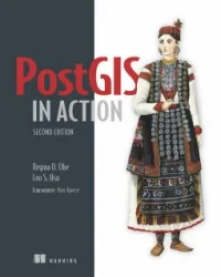
PostGIS in Action, 2nd Edition
4.2
Reviews from our users

You Can Ask your questions from this book's AI after Login
Each download or ask from book AI costs 2 points. To earn more free points, please visit the Points Guide Page and complete some valuable actions.Related Refrences:
Processing data tied to location and topology requires specialized know-how. PostGIS is a free spatial database extender for PostgreSQL, every bit as good as proprietary software. With it, you can easily create location-aware queries in just a few lines of SQL code and build the back end for a mapping, raster analysis, or routing application with minimal effort. PostGIS in Action, 2nd Edition teaches you to solve real-world geodata problems. It first gives you a background in vector-, raster-, and topology-based GIS and then quickly moves into analyzing, viewing, and mapping data. You'll learn how to optimize queries for maximum speed, simplify geometries for greater efficiency, and create custom functions for your own applications. You'll also learn how to apply your existing GIS knowledge to PostGIS and integrate with other GIS tools. Familiarity with relational database and GIS concepts is helpful but not required.
Free Direct Download
You Can Download this book after Login
Accessing books through legal platforms and public libraries not only supports the rights of authors and publishers but also contributes to the sustainability of reading culture. Before downloading, please take a moment to consider these options.
Find this book on other platforms:
WorldCat helps you find books in libraries worldwide.
See ratings, reviews, and discussions on Goodreads.
Find and buy rare or used books on AbeBooks.
1263
بازدید4.2
امتیاز0
نظر98%
رضایتReviews:
4.2
Based on 0 users review
Questions & Answers
Ask questions about this book or help others by answering
Please login to ask a question
No questions yet. Be the first to ask!
