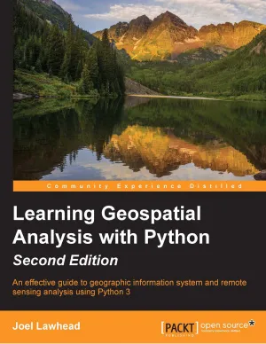
Learning Geospatial Analysis with Python: An effective guide to geographic information system and remote sensing analysis using Python 3
4.3
Reviews from our users

You Can Ask your questions from this book's AI after Login
Each download or ask from book AI costs 2 points. To earn more free points, please visit the Points Guide Page and complete some valuable actions.Related Refrences:
Introduction
Discover a comprehensive guide to mastering geospatial analysis with Python in "Learning Geospatial Analysis with Python: An effective guide to geographic information system and remote sensing analysis using Python 3". This book serves as an essential resource for anyone looking to harness the power of Python for geospatial applications, whether you are a beginner or an experienced developer seeking to enhance your skills.
Detailed Summary of the Book
Geospatial analysis is an essential component of modern geographical and environmental science. "Learning Geospatial Analysis with Python" is designed to introduce readers to the powerful capabilities of Python in processing and analyzing spatial data. Throughout the book, you'll learn how to use Python libraries like GDAL, NumPy, and others to perform complex geospatial tasks, from basic data processing to advanced remote sensing analysis.
The book begins with an overview of geospatial concepts and an introduction to Python's role in geospatial analysis. As you progress, you'll dive into detailed chapters covering data modeling, vector and raster processing, and database storage with PostGIS. You'll also explore data visualization with libraries like Matplotlib and how to use machine learning for geospatial data analysis. Each chapter is filled with practical examples and exercises, allowing you to apply your newfound skills immediately.
Key Takeaways
- Develop a solid understanding of fundamental geospatial concepts and how they are applied in Python.
- Learn to utilize key Python libraries for geospatial data manipulation and visualization.
- Master techniques for analyzing vector and raster data within Python software ecosystems.
- Gain hands-on experience with real-world examples and exercises tailored to skill-building.
- Understand how to integrate geospatial data analysis with machine learning techniques.
Famous Quotes from the Book
"Geospatial analysis may be complex, but with the versatility of Python, we can unlock new possibilities and deepen our understanding of the world."
"Mastering geospatial analysis with Python empowers you to transform data into meaningful insights, enriching decision-making processes across various sectors."
"In a digitally connected world, geospatial data not only tells us where something is but also provides contextual knowledge to address real-world challenges."
Why this Book Matters
In today's data-driven world, the ability to analyze and interpret geospatial data has never been more critical. Whether you're in urban planning, environmental science, or any field reliant on location-based insights, geospatial analysis provides a competitive edge. This book demystifies the complexities of geospatial data processing and empowers readers to build solutions that can drive impactful decisions.
Python's growing popularity as a versatile programming language makes it an ideal tool for geospatial analysis. Its extensive libraries and ease of use open opportunities for both novices and experts to innovate in geospatial data processing. This book matters as it bridges the gap between theoretical knowledge and practical application, providing readers with the tools necessary to tackle real-world geospatial challenges using Python effectively.
Free Direct Download
You Can Download this book after Login
Accessing books through legal platforms and public libraries not only supports the rights of authors and publishers but also contributes to the sustainability of reading culture. Before downloading, please take a moment to consider these options.
Find this book on other platforms:
WorldCat helps you find books in libraries worldwide.
See ratings, reviews, and discussions on Goodreads.
Find and buy rare or used books on AbeBooks.
1508
بازدید4.3
امتیاز0
نظر98%
رضایتReviews:
4.3
Based on 0 users review
Questions & Answers
Ask questions about this book or help others by answering
No questions yet. Be the first to ask!
