- Published Year: 2023
- Page count: 234
- File Size: 50 MB
- Language: English
- Published by: Packt Publishing
- Visited by: 192
- Rating/Review: 4.6
- ISBN: 180461646X; 9781804616468
Keywords:
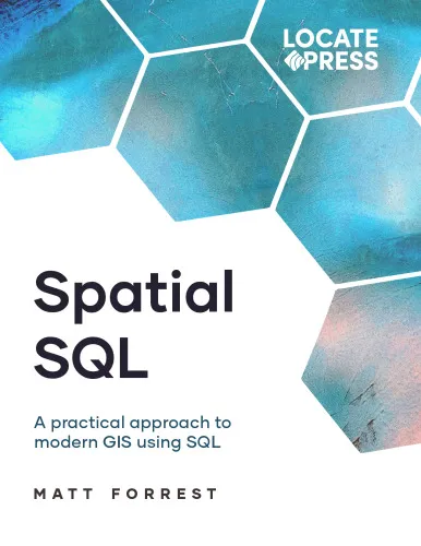
Geospatial Analysis with SQL: A hands-on guide to performing geospatial analysis by unlocking the syntax of spatial SQL
4.6
Reviews from our users

You Can Ask your questions from this book's AI after Login
Each download or ask from book AI costs 2 points. To earn more free points, please visit the Points Guide Page and complete some valuable actions.


Analytical Summary
"Geospatial Analysis with SQL: A hands-on guide to performing geospatial analysis by unlocking the syntax of spatial SQL" is a meticulously crafted resource for anyone seeking an authoritative yet practical approach to spatial data interpretation. The book empowers readers to seamlessly integrate geospatial thinking into their SQL workflows, bridging the gap between location-based insight and traditional database management.
Designed for data professionals, GIS specialists, advanced analysts, and academics, this guide dives deeply into geospatial methodologies while maintaining approachable explanations for complex SQL functions. It recognizes that spatial SQL is more than mere technical syntax—it is the language through which raw georeferenced data becomes actionable intelligence. By combining conceptual clarity with real-world case studies, the book ensures that readers can immediately apply what they learn to projects spanning environmental monitoring, urban planning, logistics optimization, and more.
Information about the publication year is unavailable due to no reliable public source. Nevertheless, the work’s timeless principles make it relevant across technological advances in spatial databases and GIS platforms. Whether leveraging PostgreSQL/PostGIS, MySQL spatial extensions, or other database technologies, the guide’s principles are adaptable and future-proof.
Key Takeaways
This book is not just a manual—it is a blueprint for spatial data mastery. Readers will come away with both theoretical understanding and applied skill in geospatial SQL queries.
You will learn how to construct spatial joins, measure distances, calculate areas, and perform advanced functions like buffering, clipping, and geofencing directly in SQL environments.
It teaches readers to interpret coordinate reference systems (CRS) effectively, ensuring accuracy in cross-platform data projects. You’ll also grasp how to optimize spatial queries for performance, as well as how to seamlessly integrate geospatial datasets into wider analytical pipelines.
Beyond syntax, the guide develops spatial thinking skills—critical for translating raw data into geographic narratives that matter in policy, commercial strategy, and scientific research.
Memorable Quotes
"Spatial SQL turns location data into decision-ready intelligence." Unknown
"Every line of spatial SQL is a key to unlock the geography hidden in your data." Unknown
"Without spatial context, data is only half a story." Unknown
Why This Book Matters
The integration of spatial analysis into SQL workflows is transforming industries. This book is a crucial asset for mastering that transformation.
Location data now permeates almost every sector: supply chains rely on route analysis, public health agencies trace epidemiological spread, and environmental scientists assess land use changes. Without the ability to process and interpret geospatial attributes directly in a database, opportunities are missed, and insights remain buried.
"Geospatial Analysis with SQL: A hands-on guide to performing geospatial analysis by unlocking the syntax of spatial SQL" stands out because it merges the rigor of academic research with the pragmatism of professional application. Its secondary emphases on spatial databases and GIS SQL queries reinforce the idea that truly integrated data analysis cannot ignore geography.
Inspiring Conclusion
Embarking on the journey through "Geospatial Analysis with SQL: A hands-on guide to performing geospatial analysis by unlocking the syntax of spatial SQL" is more than acquiring technical skills—it is embracing a new way of seeing and interpreting data.
By mastering both spatial databases and GIS SQL queries, readers position themselves at the intersection of geography and data science, opening possibilities for innovation, insight, and impact. Whether you are an academic seeking methodological rigor, a professional aiming to enhance project outcomes, or a data enthusiast eager to explore spatial intelligence, this guide is your gateway.
The next step is clear: read, share, and discuss the principles within. Apply the syntax, test the examples, and watch your spatial analysis capabilities evolve. This is not merely a book—it is a toolset that can redefine how you see the world through data.
Free Direct Download
You Can Download this book after Login
Accessing books through legal platforms and public libraries not only supports the rights of authors and publishers but also contributes to the sustainability of reading culture. Before downloading, please take a moment to consider these options.
Find this book on other platforms:
WorldCat helps you find books in libraries worldwide.
See ratings, reviews, and discussions on Goodreads.
Find and buy rare or used books on AbeBooks.

1192
بازدید4.6
امتیاز0
نظر98%
رضایتReviews:
4.6
Based on 0 users review
Questions & Answers
Ask questions about this book or help others by answering
No questions yet. Be the first to ask!