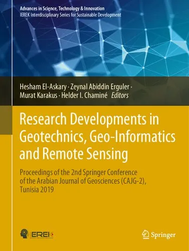
Research Developments in Geotechnics, Geo-Informatics and Remote Sensing: Proceedings of the 2nd Springer Conference of the Arabian Journal of ... in Science, Technology & Innovation)
4.5
بر اساس نظر کاربران

شما میتونید سوالاتتون در باره کتاب رو از هوش مصنوعیش بعد از ورود بپرسید
هر دانلود یا پرسش از هوش مصنوعی 2 امتیاز لازم دارد، برای بدست آوردن امتیاز رایگان، به صفحه ی راهنمای امتیازات سر بزنید و یک سری کار ارزشمند انجام بدینکتاب های مرتبط:
معرفی کتاب
کتاب "Research Developments in Geotechnics, Geo-Informatics and Remote Sensing" به بررسی پیشرفتهای جدید در حوزههای مهندسی ژئوتکنیک، Geo-Informatics و Remote Sensing میپردازد. این کتاب بخشی از مجموعه مقالههای کنفرانس دوم Springer است که توسط مجله عربی در حوزه علم، فناوری و نوآوری منتشر شده است.
خلاصهای جامع از کتاب
این کتاب مجموعهای از تحقیقات و مطالعات پیشرفته در زمینههای کلیدی مهندسی ژئوتکنیک و فنآوریهای مرتبط ارائه میکند. تمرکز اصلی کتاب بر روی تکنیکهای جدید و کاربردهای خلاقانه در Geo-Informatics و Remote Sensing است که باعث بهبود نتایج تحلیلی و تصمیمگیری موثرتر در پروژههای مهندسی میشود. از طراحی سازههای بزرگ و پایدار تا استفاده از تصاویر زمینشناسی دقیق و نقشهبرداری، این کتاب شامل جدیدترین روشها و فناوریها میباشد.
نکات کلیدی
- معرفی پیشرفتهای جدید در تکنیکهای Geo-Informatics و تاثیرات آن بر صنعت مهندسی.
- بحث در مورد کاربردهای Remote Sensing در تحلیلهای ژئوتکنیک.
- پیشبینیها و توصیهها برای آینده تحقیقاتی در این حوزهها.
نقل قولهای مشهور از کتاب
از آنجا که جهان به سمت فناوریهای دیجیتالی حرکت میکند، نقش Geo-Informatics و Remote Sensing بیش از پیش حیاتی میشود.
مهندسی ژئوتکنیک با پیوند علوم زمین و فنآوری در حال توسعه است، و باید این مسیر را با تحقیق پیش برد.
دلایل اهمیت این کتاب
این کتاب به دلیل پوشش جامع و تحلیل دقیق موضوعاتی که مستقیماً با توسعه پایدار و طراحی مهندسی در ارتباط هستند اهمیت دارد. با پیشرفتهای پیوسته در تکنولوژی و نیاز به ساختارهای ایمن و بادوام، درک بهتر از Geo-Informatics و Remote Sensing به مهندسان و جامعه علمی کمک خواهد کرد تا به راهحلهای نوآورانه و کارآمدتری دست یابند. این اثر نه تنها برای محققان، بلکه برای پژوهشگران، دانشجویان و متخصصان در زمینههای مرتبط نیز منبع ارزشمندی به شمار میرود.
Introduction
Welcome to "Research Developments in Geotechnics, Geo-Informatics and Remote Sensing," a comprehensive collection of insights and findings from the 2nd Springer Conference of the Arabian Journal of Science, Technology & Innovation. This book serves as a significant academic offering, bringing together cutting-edge research and developments in the dynamic fields of geotechnics, geo-informatics, and remote sensing.
Detailed Summary
The book encapsulates a wide spectrum of research papers and discussions presented at the conference, focusing on the latest advancements and methodologies in geotechnical engineering, geo-informatics, and remote sensing technologies. It provides an in-depth look into issues related to earth sciences, including soil mechanics, rock engineering, spatial data analysis, and satellite technology applications. Each chapter has been meticulously crafted to provide in-depth analyses and novel insights into these fields, ensuring that it is not just a compilation of information, but a stimulating discourse for professionals, researchers, and academics alike.
The contributors to this volume are experts from all over the globe, each bringing their unique perspectives and innovations. Topics range from practical engineering solutions and computational techniques to theoretical models and experimental breakthroughs, offering a holistic view of the state-of-the-art technologies and challenges currently being addressed in the field.
Key Takeaways
- Understanding the foundational principles and advanced discoveries in geotechnics and how they apply to real-world engineering challenges.
- Gaining insights into the role of geo-informatics in data analysis and decision-making processes, enhancing the efficiency of infrastructure projects.
- Exploring the application of remote sensing technologies in monitoring, mapping, and managing environmental and geological conditions.
- Appreciating the interdisciplinary approach and collaboration required to solve complex problems in earth sciences.
Famous Quotes from the Book
"In an increasingly digital world, the intersection of geotechnics and geo-informatics is not merely a convenience, but a necessity for informed decision-making." - Chapter 2
"Remote sensing bridges the gap between theory and practice, offering unparalleled insight into our planet's dynamic systems." - Chapter 5
Why This Book Matters
This book is of paramount importance in a time where understanding our earth and its processes is more critical than ever. The combination of geotechnics, geo-informatics, and remote sensing is not only advancing our scientific knowledge but is also playing a pivotal role in addressing critical global challenges such as climate change, natural disaster management, and sustainable development.
The value of this volume lies in its ability to serve as both a reference and a source of inspiration. For practitioners and policy-makers, the book offers actionable insights that can be directly applied in the field. For researchers and academics, it paves the way for future studies and innovative practices. Moreover, the book highlights the importance of fostering interdisciplinary collaborations to tackle the complexities of earth and environmental sciences.
In summary, "Research Developments in Geotechnics, Geo-Informatics and Remote Sensing" is not just a collection of academic papers, but a fundamental resource for anyone involved in or studying the vast, interconnected realms of earth sciences. It represents a significant step forward in our collective understanding and capacity to harness scientific advancements for the betterment of society and the environment.
دانلود رایگان مستقیم
شما میتونید سوالاتتون در باره کتاب رو از هوش مصنوعیش بعد از ورود بپرسید
دسترسی به کتابها از طریق پلتفرمهای قانونی و کتابخانههای عمومی نه تنها از حقوق نویسندگان و ناشران حمایت میکند، بلکه به پایداری فرهنگ کتابخوانی نیز کمک میرساند. پیش از دانلود، لحظهای به بررسی این گزینهها فکر کنید.
این کتاب رو در پلتفرم های دیگه ببینید
WorldCat به شما کمک میکنه تا کتاب ها رو در کتابخانه های سراسر دنیا پیدا کنید
امتیازها، نظرات تخصصی و صحبت ها درباره کتاب را در Goodreads ببینید
کتابهای کمیاب یا دست دوم را در AbeBooks پیدا کنید و بخرید
1273
بازدید4.5
امتیاز0
نظر98%
رضایتنظرات:
4.5
بر اساس 0 نظر کاربران
Questions & Answers
Ask questions about this book or help others by answering
No questions yet. Be the first to ask!
