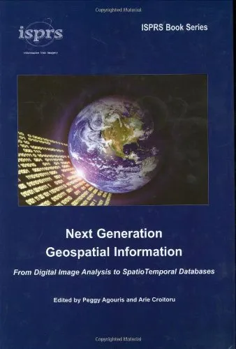
Next Generation Geospatial Information From Digital Image Analysis to Spatiotemporal Databases
4.8
بر اساس نظر کاربران

شما میتونید سوالاتتون در باره کتاب رو از هوش مصنوعیش بعد از ورود بپرسید
هر دانلود یا پرسش از هوش مصنوعی 2 امتیاز لازم دارد، برای بدست آوردن امتیاز رایگان، به صفحه ی راهنمای امتیازات سر بزنید و یک سری کار ارزشمند انجام بدینکتاب های مرتبط:
معرفی کتاب
کتاب 'Next Generation Geospatial Information From Digital Image Analysis to Spatiotemporal Databases' اثری جامع است که به بررسی تکنولوژیهای پیشرفته در حوزه اطلاعات جغرافیایی پرداخته و مباحثی از تحلیل تصاویر دیجیتال تا بانکهای دادههای Spatiotemporal را شامل میشود. این کتاب به دست 'Peggy Agouris' و 'Arie Croitoru' نگاشته شده و بهطور ویژه به کاربردها و پیشرفتهای نوین در زمینه اطلاعات مکانی میپردازد.
خلاصهای از کتاب
با پیشرفت فناوریهای نوین، اطلاعات جغرافیایی نقش بسیار مهمی در تحلیل دادههای مکانی ایفا میکنند. این کتاب به بررسی ابزارها و روشهایی پرداخته که به پژوهشگران و متخصصان کمک میکند تا از اطلاعات دقیقتری در زمینه جغرافیایی بهرهمند شوند. فصلهای مختلف این کتاب به تحلیل تصاویر دیجیتال، جمعآوری دادههای دقیق مکانی، و توسعهی بانکهای دادههای Spatiotemporal میپردازد. در این کتاب بهصورت ویژه به موضوعات تحلیل زمانی و مکانی پرداخته شده تا بتوان دادهها را بهشکلی معنادار درک کرد.
نکات کلیدی
- فهم کامل روند تحلیل و پردازش اطلاعات جغرافیایی و اهمیت آن در زمینههای مختلف علمی.
- بررسی فناوریهای نوین در جمعآوری و استفاده از دادههای مکانی و زمانی.
- نقش پایگاههای دادههای پیشرفته در مدیریت و تحلیل دادههای بزرگ جغرافیایی.
نقلقولهای معروف
“در دنیای امروزی، تحلیل دقیقتر دادههای مکانی میتواند پاسخی برای بسیاری از چالشهای کلان زیست محیطی و شهری باشد.”
“آیندهنگری در دادههای جغرافیایی به معنی استفاده از ابزارهای نوین برای فهم بهتر محیط پیرامون ماست.”
چرا این کتاب مهم است
با گسترش فناوری و رشد روزافزون دادهها، نیاز به تحلیل و بررسی دقیقتر اطلاعات جغرافیایی بیش از پیش احساس میشود. این کتاب بهعنوان منبعی علمی و کارآمد برای متخصصان و محققان حوزه اطلاعات مکانی در نظر گرفته میشود. راهکارهای ارائه شده در کتاب میتواند تاثیر بسزایی در مدیریت منابع طبیعی، برنامهریزی شهری، و بسیاری از حوزههای دیگر داشته باشد. کاربردهای گسترده این اطلاعات میتواند به بهبود تصمیمگیریها و نظریهپردازیهای علمی کمک کند و بدین ترتیب اهمیت این کتاب دوچندان میشود.
Introduction
Welcome to "Next Generation Geospatial Information: From Digital Image Analysis to Spatiotemporal Databases". In an era driven by data and technology, understanding and utilizing geospatial information stands as a cornerstone for development in various fields. This book delves deep into the evolving landscape of geospatial information, providing insights into digital image analysis, database management, and the integration of these technologies into comprehensive systems. We aim to furnish professionals, educators, and students in the geospatial domain with an enriched understanding, empowering them to leverage cutting-edge techniques and methodologies.
Detailed Summary of the Book
The book begins by exploring the foundational concepts of geospatial information systems (GIS), tracing the progression from traditional cartography to modern-day applications that employ sophisticated digital technologies. We introduce readers to digital image analysis, discussing its critical role in interpreting and extracting meaningful data from visual media. As we transition from static datasets to dynamic, time-sensitive information, the importance of integrating data seamlessly into spatiotemporal databases becomes evident.
Subsequent chapters dissect the methodologies for processing and interpreting data from satellite and aerial imagery. We offer an in-depth perspective on the algorithms and techniques that underlie these processes, preparing readers to tackle real-world challenges in data acquisition and processing. Through substantial technical detail and theoretic foundations, practitioners and academics alike will gain a comprehensive toolkit for addressing both current phenomena in geospatial data and anticipating future trends.
The latter sections of the book delve into database design and management tailored to spatial and temporal data. Here, we examine strategies for storing, managing, and retrieving complex geospatial datasets efficiently. Scenarios from urban planning to environmental monitoring showcase how integrating digital image analysis with temporal databases offers profound insights and supports informed decision-making.
Key Takeaways
- Master the integration of digital image analysis with advanced geospatial systems.
- Understand the significance of spatiotemporal data in modern GIS applications.
- Gain insights into deploying theoretical knowledge in practical scenarios.
- Get equipped with tools to handle large-scale, dynamic datasets effectively.
Famous Quotes from the Book
"In the convergence of images and information lies the power to transform the world." - An insight into the potential of digital imagery in the geospatial domain.
"Spatiotemporal databases are not just tools, but the scaffolding of modern urban and environmental planning." - Highlighting the importance of databases in the contemporary geospatial landscape.
Why This Book Matters
As the demand for precise geospatial information escalates across various sectors, this book provides the roadmap to navigating and mastering next-generation GIS technologies. It bridges the gap between digital image analysis and the expansive possibilities presented by spatiotemporal databases, equipping readers with the knowledge to innovate and impact fields ranging from urban development to emergency response and beyond.
By elucidating the concepts and techniques that are shaping the future of geospatial data, "Next Generation Geospatial Information" stands as more than just a textbook. It is a call to action for professionals and scholars in geospatial sciences to embrace a data-driven future powered by advanced digital methodologies and databases, offering their skills to ever-evolving societal needs.
دانلود رایگان مستقیم
شما میتونید سوالاتتون در باره کتاب رو از هوش مصنوعیش بعد از ورود بپرسید
دسترسی به کتابها از طریق پلتفرمهای قانونی و کتابخانههای عمومی نه تنها از حقوق نویسندگان و ناشران حمایت میکند، بلکه به پایداری فرهنگ کتابخوانی نیز کمک میرساند. پیش از دانلود، لحظهای به بررسی این گزینهها فکر کنید.
این کتاب رو در پلتفرم های دیگه ببینید
WorldCat به شما کمک میکنه تا کتاب ها رو در کتابخانه های سراسر دنیا پیدا کنید
امتیازها، نظرات تخصصی و صحبت ها درباره کتاب را در Goodreads ببینید
کتابهای کمیاب یا دست دوم را در AbeBooks پیدا کنید و بخرید
1303
بازدید4.8
امتیاز0
نظر98%
رضایتنظرات:
4.8
بر اساس 0 نظر کاربران
Questions & Answers
Ask questions about this book or help others by answering
No questions yet. Be the first to ask!


