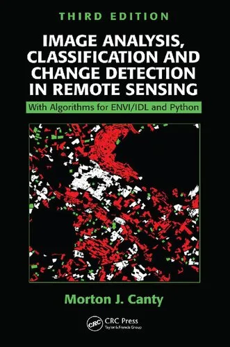
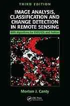
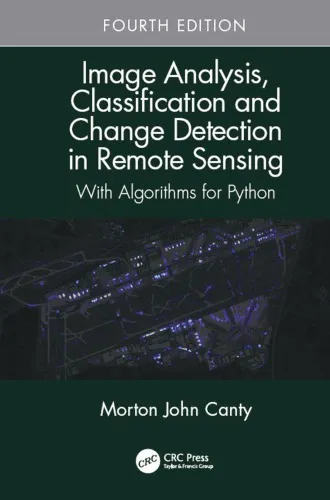
Image Analysis, Classification and Change Detection in Remote Sensing: With Algorithms for Python, Fourth Edition
4.5
بر اساس نظر کاربران

شما میتونید سوالاتتون در باره کتاب رو از هوش مصنوعیش بعد از ورود بپرسید
هر دانلود یا پرسش از هوش مصنوعی 2 امتیاز لازم دارد، برای بدست آوردن امتیاز رایگان، به صفحه ی راهنمای امتیازات سر بزنید و یک سری کار ارزشمند انجام بدینکتاب های مرتبط:
معرفی کتاب
کتاب Image Analysis, Classification and Change Detection in Remote Sensing: With Algorithms for Python, Fourth Edition یکی از منابع برجسته در زمینه سنجش از دور است که به تحلیل تصاویر، طبقهبندی و آشکارسازی تغییرات با استفاده از الگوریتمهای کاربردی در Python اختصاص دارد. این کتاب، نسخه چهارم و بهروزشدهای است که به دانشجویان، محققان و متخصصان این حوزه ابزارهای لازم برای تحلیل دادههای تصویری زمین را ارائه میدهد.
خلاصه مفصل کتاب
این کتاب به بررسی اصول و روشهای نوین در بررسی دادههای سنجش از دور میپردازد. موضوع اصلی آن شامل سه بخش کلیدی است: تحلیل تصاویر (Image Analysis)، طبقهبندی (Classification) و آشکارسازی تغییر (Change Detection). هر یک از این بخشها به طور جامع بررسی میشوند و مثالهای متعددی در Python ارائه میشوند تا خوانندگان بتوانند دانش تئوری خود را به عمل تبدیل کنند.
در ابتدا، مبانی پردازش تصاویر سنجش از دور، از جمله مفاهیمی مانند بازتاب طیفی، تحلیل دادههای چندطیفی و بازنمایی تصاویر دیجیتال، بررسی میشوند. سپس تکنیکهای پیشرفته طبقهبندی، مانند Support Vector Machines (SVM)، Random Forest و سایر روشهای یادگیری ماشین، به طور مفصل شرح داده شدهاند. بخش پایانی بر موضوع آشکارسازی تغییرات تمرکز دارد و ابزارهایی ارائه میدهد که تغییرات در طول زمان را در دادههای سریهای زمانی بهتر درک کنیم.
این نسخه جدید شامل توضیحاتی بهروز و مثالهای Python است که با استفاده از کتابخانههایی مانند NumPy، SciPy و scikit-learn توسعه یافتهاند. این امر به خوانندگان کمک میکند تا مفاهیم پیچیده را به صورت عملی تجربه کنند.
آموختههای کلیدی از کتاب
- درک عمیق از مبانی سنجش از دور و تحلیل تصاویر
- آموزش اصول طبقهبندی تصاویر با استفاده از الگوریتمهای پیشرفته
- معرفی تکنیکهای آشکارسازی تغییر در دادههای سریهای زمانی
- آشنایی عملی با الگوریتمهای Python در پردازش دادههای سنجش از دور
- یادگیری کاربردهای جذاب یادگیری ماشین در تحلیل دادههای تصویری
نقلقولهای معروف از کتاب
"The marriage between remote sensing data and machine learning algorithms is the new frontier of image analysis."
"Change detection is not just about observing differences; it’s about interpreting the dynamics of our environment."
چرا این کتاب مهم است؟
با پیشرفت روزافزون فناوری سنجش از دور و مهارتهای تجزیهوتحلیل داده، تقاضا برای متخصصانی که توانایی تحلیل دادههای تصویری پیچیده را دارند، به شدت افزایش یافته است. این کتاب به عنوان یک منبع کامل و جامع، ابزارهای لازم برای تبدیل دانش تئوریک به توانایی عملی را فراهم میآورد.
یکی دیگر از دلایل اهمیت این کتاب، تمرکز خاص آن بر ادغام دادههای سنجش از دور با الگوریتمهای Python است. Python به دلیل انعطافپذیری و قدرت بسیار زیاد خود در پردازش دادهها، انتخاب اصلی در این زمینه محسوب میشود. این کتاب نه تنها مباحث فنی را پوشش میدهد، بلکه به خوانندگان کمک میکند تا از آنها در پروژههای واقعی استفاده کنند.
به همین دلیل، این منبع ارزشمند برای دانشجویان، محققان، و حرفهایهایی که به دنبال توسعه دانش خود در این حوزه هستند، ضروری است.
Introduction to "Image Analysis, Classification and Change Detection in Remote Sensing: With Algorithms for Python, Fourth Edition"
The field of remote sensing has evolved dramatically over the past few decades, fostering significant advancements in image analysis and interpretation. My book, "Image Analysis, Classification and Change Detection in Remote Sensing: With Algorithms for Python, Fourth Edition," offers a comprehensive guide targeted at exploring the theoretical underpinnings and practical implementations of image analysis techniques. With a focus on Python programming, this edition is meticulously designed to cater to beginners, researchers, and advanced practitioners alike, ensuring a seamless understanding of both core concepts and cutting-edge practices.
Detailed Summary of the Book
Remote sensing is an interdisciplinary science that integrates knowledge from physics, computer science, and geography to extract meaningful insights from Earth observation data. This book serves as an all-encompassing resource that dives deep into the fundamental principles of remote sensing, the tools required for image analysis, and the development of sophisticated algorithms for classification and change detection.
The fourth edition shifts its focus toward Python, incorporating open-source libraries such as NumPy, SciPy, matplotlib, and GDAL to harness the power of computational image analysis. Practicality takes center stage, as numerous coding examples are presented throughout the material to strengthen the learning experience. From advanced filtering and feature extraction to supervised and unsupervised classification methods, the book systematically explores a variety of image processing techniques. It also dedicates significant attention to the application of machine learning algorithms, offering insights into how these methods can streamline tasks like land cover classification and environmental monitoring.
A unique feature of this book is its focus on change detection strategies, enabling users to monitor temporal changes in satellite imagery effectively. With practical implementation guides, discussion of real-life remote sensing challenges, and in-depth explanations of statistical methodologies, readers will emerge equipped to deal with a diverse range of tasks—whether developing their own algorithms or analyzing multi-temporal datasets.
Key Takeaways
- Thorough understanding of remote sensing principles, techniques, and datasets.
- Hands-on knowledge of Python's essential libraries for geospatial image analysis.
- Practical implementation of supervised and unsupervised classification algorithms.
- Comprehensive workflows for change detection and multi-temporal analysis.
- Exposure to the latest advancements in image processing and machine learning for remote sensing.
- Step-by-step guidance on creating algorithms tailored to specific research needs.
Famous Quotes from the Book
"In remote sensing, every pixel is worth a thousand measurements. Understanding the overwhelming complexity of data is what turns images into actionable insights."
"Classification is not merely a task of grouping pixels; it is a scientific endeavor to identify patterns and relationships within the imagery, to unlock the secrets of our world."
Why This Book Matters
This book matters because it fills a critical gap in the intersection of remote sensing and software implementation. While many texts discuss the theoretical aspects of image analysis, few offer a balanced combination of theory and practical exercises, particularly with open-source tools like Python.
In an era where data-driven decisions shape industries, this book empowers readers to use satellite imagery for solving real-world problems—from environmental monitoring to urban planning. It provides a toolkit for professionals and academics who are looking to transition from conceptual learning to hands-on expertise.
Furthermore, its focus on open-source solutions ensures that the methods discussed are accessible and scalable, democratizing remote sensing education in a meaningful way. The fourth edition's emphasis on Python makes it especially relevant in today’s world, where Python has become a dominant programming language in the fields of data science and machine learning.
For anyone seeking a comprehensive, practical, and accessible introduction to remote sensing with Python, this book is an invaluable resource that will guide you through basic concepts all the way to advanced applications.
دانلود رایگان مستقیم
شما میتونید سوالاتتون در باره کتاب رو از هوش مصنوعیش بعد از ورود بپرسید
دسترسی به کتابها از طریق پلتفرمهای قانونی و کتابخانههای عمومی نه تنها از حقوق نویسندگان و ناشران حمایت میکند، بلکه به پایداری فرهنگ کتابخوانی نیز کمک میرساند. پیش از دانلود، لحظهای به بررسی این گزینهها فکر کنید.
این کتاب رو در پلتفرم های دیگه ببینید
WorldCat به شما کمک میکنه تا کتاب ها رو در کتابخانه های سراسر دنیا پیدا کنید
امتیازها، نظرات تخصصی و صحبت ها درباره کتاب را در Goodreads ببینید
کتابهای کمیاب یا دست دوم را در AbeBooks پیدا کنید و بخرید
1416
بازدید4.5
امتیاز0
نظر98%
رضایتنظرات:
4.5
بر اساس 0 نظر کاربران
Questions & Answers
Ask questions about this book or help others by answering
No questions yet. Be the first to ask!
