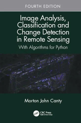
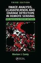
Image analysis, classification and change detection in remote sensing : with algorithms for Python
4.5
بر اساس نظر کاربران

شما میتونید سوالاتتون در باره کتاب رو از هوش مصنوعیش بعد از ورود بپرسید
هر دانلود یا پرسش از هوش مصنوعی 2 امتیاز لازم دارد، برای بدست آوردن امتیاز رایگان، به صفحه ی راهنمای امتیازات سر بزنید و یک سری کار ارزشمند انجام بدینکتاب های مرتبط:
معرفی کتاب
کتاب "Image Analysis, Classification and Change Detection in Remote Sensing: With Algorithms for Python" اثر M.J. Canty یکی از جامعترین منابع در زمینه تحلیل دادههای سنجشازدور است که با استفاده از الگوریتمهای Python نوشته شده است. این کتاب بهطور خاص بر روشهای تحلیل تصاویر ماهوارهای، طبقهبندی دادهها و شناسایی تغییرات تمرکز دارد و بهعنوان مرجعی استاندارد در این حوزه شناخته میشود. مخاطبان اصلی این کتاب دانشجویان، پژوهشگران و متخصصین در زمینه سنجشازدور، GIS و علوم محیطی هستند که مایل به یادگیری ابزارهای پیشرفته در تحلیل دادههای تصویری هستند.
خلاصهای از کتاب
این کتاب ساختاری سیستماتیک برای درک و استفاده از تحلیلهای مختلف تصاویر سنجشازدور ارائه میدهد. در فصلهای ابتدایی، مبانی برداشتهای ماهوارهای و اصول پردازش تصویر توضیح داده شدهاند. سپس ابزارها و الگوریتمهای Python برای انجام تحلیلهایی همچون طبقهبندی، کاهش نویز و شناسایی تغییرات معرفی میشوند.
یکی از ویژگیهای برجسته این کتاب پوشش تئوری و عملی هر مبحث است. مثالهای Python ارائه شده در کتاب، مرحله به مرحله جامعه عمل میپوشانند و به کاربران این امکان را میدهند تا خود الگوریتمها را اجرا کرده و نتایج را تحلیل کنند. علاوه بر این، موضوعاتی همچون Principal Component Analysis (PCA)، Object-Based Image Analysis (OBIA)، و روشهای نوین Machine Learning برای دادههای تصویری نیز به تفصیل آموزش داده شدهاند.
نکات کلیدی و دستاوردهای کتاب
- ارائه پیادهسازیهای کامل الگوریتمها با Python برای تحلیل تصاویر سنجشازدور.
- توضیح مبانی تئوریک و ارتباط آنها با کاربردهای عملی در علم محیطزیست و مدیریت منابع.
- آموزش جامع طبقهبندی تصاویر، از روشهای مبتنی بر Rule-Based تا Machine Learning.
- ارائه روشهای شناسایی تغییرات با تمرکز بر ثبت (Registration) و بررسی تغییرات چندزمانه (Multitemporal Change Detection).
- کاربردهای پیشرفته مثل استفاده از Hyperspectral Data و روشهای Cross-validation برای ارزیابی مدلها.
جملات معروف از کتاب
"Data acquired through remote sensing are not just numbers; they are insights into our dynamic planet."
"Python, while a powerful language, truly shines when we exploit its scientific libraries for solving complex image analysis challenges."
"The fusion of imagery and data science allows researchers to address pressing environmental concerns with unprecedented precision."
چرا این کتاب اهمیت دارد؟
کتاب "Image Analysis, Classification and Change Detection in Remote Sensing" درک عمیقی از چگونگی استفاده از تصاویر ماهوارهای برای تحقیقات محیط زیستی، نظارتی و جامعهشناختی ارائه میدهد. با استفاده روزافزون از سنسورها و دادههای ماهوارهای، دانش مرتبط با تحلیل دادههای سنجشازدور اهمیت فزایندهای پیدا کرده است. این کتاب نه تنها در زمینه آموزش مهارتهای تکنیکی کمکرسان است، بلکه در شناخت چگونگی استفاده خلاقانه از دادهها برای یافتن راهحلهای واقعی نیز الهامبخش است.
از آنجا که Python یکی از پرکاربردترین زبانها در علم داده و تحلیل تصاویر است، این کتاب الگویی عملی و قابل فهم برای یادگیری آن در حوزه سنجشازدور فراهم میکند. از طرف دیگر، کاربردی بودن این مطالب و تمرینهای عملی باعث میشود دانشجویان و متخصصان بتوانند دانش خود را مستقیماً به محیط کاری منتقل کنند.
Introduction to "Image Analysis, Classification and Change Detection in Remote Sensing: With Algorithms for Python"
Advances in remote sensing technology have revolutionized our ability to analyze the Earth's surface, enabling scientists, researchers, and professionals to extract meaningful information from satellite and aerial imagery. "Image Analysis, Classification and Change Detection in Remote Sensing: With Algorithms for Python" serves as a comprehensive resource for anyone looking to harness the power of remote sensing through the lens of Python programming. This book provides a hands-on approach to understanding and implementing geospatial techniques, making it an invaluable guide for students, academics, and researchers.
Detailed Summary of the Book
The book begins by exploring the fundamental concepts of remote sensing, laying a solid foundation in image processing, feature extraction, and classification techniques. From there, it delves into more advanced topics, such as image fusion, object-based classification, and spatio-temporal analysis. A defining characteristic of this book is its practical approach—each theoretical concept is accompanied by real-world examples and Python implementation demos that readers can follow step-by-step.
With a focus on change detection, the book explores methods to analyze temporal differences between images, allowing users to identify alterations in land use, urbanization, deforestation, natural disaster impacts, and more. By combining theoretical frameworks with hands-on Python algorithms, readers gain crucial insight into both the academic principles and practical skills required in remote sensing applications.
Written with accessibility and rigor in mind, the book assumes no advanced programming experience, making it a fantastic resource for beginners eager to grasp Python. At the same time, experienced practitioners will appreciate the sophisticated algorithms and cutting-edge techniques presented within, ensuring that this book has something valuable for all skill levels.
Key Takeaways
- Comprehensive understanding of remote sensing principles and their real-world applications.
- Step-by-step implementation of image classification and change detection algorithms using Python.
- Hands-on exercises and case studies to foster learning and practical application.
- Coverage of advanced topics such as object-based classification and multitemporal image analysis.
- Focus on reproducibility and open-source tools for transparency in scientific studies.
- Insights into effective data management, preprocessing, and accuracy assessment techniques.
- Practical guidance on building predictive models for sustainable development and environmental monitoring.
Famous Quotes from the Book
"In the era of big data and machine learning, the ability to extract meaningful insights from remote sensing imagery is no longer optional—it's essential."
"Change detection is more than simply tracking environmental shifts; it’s a pathway to understanding how human activity and nature interact over time."
"Python’s simplicity and versatility make it an ideal choice for tackling the challenges of modern geospatial analysis."
Why This Book Matters
The field of remote sensing is evolving rapidly, driven by the increasing availability of high-resolution satellite data and advancements in computational tools. This book matters because it bridges the gap between theoretical concepts and their practical applications using Python—one of the most widely used programming languages in scientific computing. By providing transparent, reproducible methods, it empowers readers to conduct robust analyses that contribute to sustainable development, disaster management, agricultural monitoring, urban planning, and more.
Furthermore, the focus on Python-based algorithms ensures that readers can leverage open-source libraries like NumPy, SciPy, and scikit-learn, minimizing barriers to entry while promoting accessibility. In an academic landscape that increasingly prioritizes transparency and reproducibility, the book's emphasis on sharing tools and code represents a vital contribution to modern remote sensing research.
For aspiring remote sensing professionals, this book offers a rare synthesis of clarity, rigor, and usability. It prepares readers not only to understand the intricacies of Earth observation and monitoring but also to apply high-level analyses in practical, results-driven projects. "Image Analysis, Classification and Change Detection in Remote Sensing: With Algorithms for Python" ultimately serves as both a foundational text and a forward-looking guide, positioning itself as a must-read for any geospatial enthusiast.
دانلود رایگان مستقیم
شما میتونید سوالاتتون در باره کتاب رو از هوش مصنوعیش بعد از ورود بپرسید
دسترسی به کتابها از طریق پلتفرمهای قانونی و کتابخانههای عمومی نه تنها از حقوق نویسندگان و ناشران حمایت میکند، بلکه به پایداری فرهنگ کتابخوانی نیز کمک میرساند. پیش از دانلود، لحظهای به بررسی این گزینهها فکر کنید.
این کتاب رو در پلتفرم های دیگه ببینید
WorldCat به شما کمک میکنه تا کتاب ها رو در کتابخانه های سراسر دنیا پیدا کنید
امتیازها، نظرات تخصصی و صحبت ها درباره کتاب را در Goodreads ببینید
کتابهای کمیاب یا دست دوم را در AbeBooks پیدا کنید و بخرید
1444
بازدید4.5
امتیاز0
نظر98%
رضایتنظرات:
4.5
بر اساس 0 نظر کاربران
Questions & Answers
Ask questions about this book or help others by answering
No questions yet. Be the first to ask!
