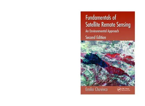
Fundamentals of Satellite Remote Sensing: An Environmental Approach, Second Edition
4.5
بر اساس نظر کاربران

شما میتونید سوالاتتون در باره کتاب رو از هوش مصنوعیش بعد از ورود بپرسید
هر دانلود یا پرسش از هوش مصنوعی 2 امتیاز لازم دارد، برای بدست آوردن امتیاز رایگان، به صفحه ی راهنمای امتیازات سر بزنید و یک سری کار ارزشمند انجام بدینکتاب های مرتبط:
معرفی کتاب
کتاب Fundamentals of Satellite Remote Sensing: An Environmental Approach, Second Edition یکی از منابع اصلی و معتبر در زمینه دانش Remote Sensing یا سنجش از دور است که توسط من، "امیلیو چوییکو"، تألیف شده است. هدف اصلی این کتاب، ارائه یک نگاه کلی و جامع به اصول و فنون مرتبط با ماهوارههای مشاهده زمین و کاربردهای گسترده آنها در مطالعات محیط زیستی است. این نسخه دوم نه تنها بهروزرسانیهای قابل توجهی در محتوا ارائه کرده، بلکه به صورتی روانتر و جامعتر اطلاعات را برای خوانندگان، بهویژه دانشجویان و متخصصان محیط زیست، بیان میکند.
خلاصهای از کتاب
در این کتاب، از مفاهیم بنیادی فیزیک رادیومتریک و اصول عملکرد سنجش از دور گرفته تا کاربردهای عملی در مدیریت محیط زیست و تغییرات اقلیمی مطرح میشود. هر فصل از کتاب با توضیحات روششناسانه آغاز میشود و در ادامه، با مثالهای واقعی و تصاویر ماهوارهای جذاب تکمیل میگردد. موضوعات کلیدی شامل اصول نقشهبرداری، پردازش دادههای ماهوارهای، تحلیلهای آماری در تصاویر سنجشی و بررسی چرخههای محیط زیستی با استفاده از فناوریهای سنجش از دور هستند.
این کتاب همچنین روششناسی گردآوری دادهها، پردازشهای دیجیتال و کاربردهای عملی تصاویر ماهوارهای برای تحلیل مسائل مختلف، نظیر تغییر کاربری زمین، جنگلزدایی، توسعه شهری و مدیریت منابع آبی را دربرمیگیرد. بهعلاوه، فصولی به تحلیل حرارتی، طیفی و زمانی دادههای ماهوارهای اختصاص داده شده است.
نکات کلیدی
- مقدمهای جامع بر اساس دانش فیزیک پایه در سنجش از دور.
- کاربردهای پیشرفته در پایش محیط زیست و مدیریت منابع.
- پردازش و تحلیل پیشرفته دادههای دیجیتال از تصاویر ماهوارهای.
- بررسی عمیق اصول ابزارهای ماهوارهای و سیستمهای ردیابی از راه دور.
- استفاده از مثالهای عملی برای درک بهتر مفاهیم تئوریک.
جملات معروف کتاب
"Understanding the way our planet evolves through satellite eyes will not only deepen our knowledge but also grant us the tools to preserve our natural resources."
"Environmental challenges require technological solutions, and Remote Sensing has become an essential tool to address these global issues."
چرا این کتاب اهمیت دارد؟
با رشد روزافزون تغییرات اقلیمی و مسائل زیستمحیطی، اهمیت پایش محیطی و ارائه راهکارهای پایدار بیش از هر زمان دیگری احساس میشود. این کتاب بهعنوان یکی از منابع مهم برای دانشجویان، محققان و متخصصان در حوزه محیط زیست و علوم زمین، فرصتی را فراهم میکند تا از قویترین ابزارهای تکنولوژیک موجود، یعنی تصاویر ماهوارهای، به بهترین نحو استفاده کنند. این منابع امکان تحلیل دقیقتر و تصمیمگیری آگاهانهتری را برای تصمیمسازان فراهم میآورند.
علاوه بر این، کتاب به افرادی که در این حوزه تازهکار هستند کمک میکند تا به درک کاملی از مفاهیم کلیدی دست پیدا کنند، در حالی که برای متخصصان پیشرفته هم منابع مفیدی ارائه میدهد. با استفاده از مثالهای واقعی و تمرینهای مختلف، مخاطب میتواند توانایی خود را در تحلیل دادههای سنجشی ارتقاء دهد.
در نهایت، Fundamentals of Satellite Remote Sensing بهعنوان یکی از منابع معتبر و استاندارد در این حوزه، به تمامی کسانی که به علم و تکنولوژی علاقه دارند، توصیه میشود.
Introduction
Welcome to the second edition of Fundamentals of Satellite Remote Sensing: An Environmental Approach. This comprehensive guide dives deep into the foundational principles, methods, and applications of remote sensing, offering readers a robust understanding of how satellite-based observations are transforming environmental monitoring and assessment. This updated edition reflects advancements in satellite sensing technologies, data analysis techniques, and emerging applications across a variety of environmental disciplines.
Remote sensing has become indispensable in today’s scientific and technological landscape. By delivering precise, broad-scale, and rapidly-acquired environmental data, satellite imagery supports better decision-making for sustainability, resource management, and climate action. This book integrates both theoretical concepts and practical applications, providing readers with a well-rounded perspective. Whether you are a student, a professional researcher, or an industry practitioner, this book equips you with the knowledge to utilize and understand the power of satellite remote sensing.
Summary of the Book
The second edition of Fundamentals of Satellite Remote Sensing builds on the strengths of its predecessor while incorporating significant updates to reflect the latest developments in the field. The book is meticulously structured to provide a step-by-step guide to the key concepts of remote sensing: from fundamental electromagnetic theory and sensor technology to advanced image processing methods and real-world environmental applications.
The text is organized around three primary themes: the science behind remote sensing, the diversity of sensors and platforms used for different objectives, and the increasingly varied applications in environmental studies. Topics covered include:
- Electromagnetic radiation principles and their role in remote sensing
- Overview of satellite systems, including optical, thermal, and radar sensors
- Methods for processing and analyzing remotely sensed data
- Applications of remote sensing for land, water, vegetation, and atmospheric monitoring
- Climate change, natural disaster management, and urban development applications
This edition also places a greater emphasis on data from recent satellites, open-access tools for image analysis, and case studies that highlight the growing relevance of remote sensing in addressing global environmental challenges.
Key Takeaways
- Comprehensive Knowledge: Learn how satellite remote sensing operates, from the physics of electromagnetic radiation to modern processing software.
- Real-World Applications: Explore how remote sensing supports diverse environmental fields, including forestry, water management, agriculture, and climate monitoring.
- Interactive Examples: Engage with case studies and exercises to connect theoretical concepts with practical applications.
- Up-to-Date Content: Understand how current satellite systems and open-data initiatives have democratized access to geospatial information.
- Problem-Solving Skills: Develop analytical methods to interpret satellite images and solve spatial problems.
Famous Quotes from the Book
"Remote sensing isn’t just about technology; it’s about understanding our Earth and addressing the challenges that threaten its sustainability."
"As the eyes of satellites scan the planet, they reveal its beauty as well as its fragility."
"In the age of big data, satellite imagery serves as one of the richest sources of spatial information for understanding our world."
Why this Book Matters
The field of satellite remote sensing sits at the heart of modern environmental science and technology. This book matters because it empowers readers from diverse academic and professional backgrounds to effectively engage with the tools of remote sensing and apply them to solve pressing ecological and societal challenges.
Sustainability, climate resilience, and mitigation of environmental risks require innovative and scalable solutions, many of which can only be achieved using satellite observations. By bridging the gap between theory and practice, this book fosters a deeper understanding of how remote sensing technologies contribute to conservation, resource optimization, and a better understanding of global environmental changes. Moreover, the book emphasizes collaboration by introducing open-access tools that enable equitable participation in this rapidly evolving field.
In an era when data-driven decision-making is essential, Fundamentals of Satellite Remote Sensing: An Environmental Approach remains a crucial resource for anyone aspiring to work at the intersection of environmental sciences and geospatial technology.
دانلود رایگان مستقیم
شما میتونید سوالاتتون در باره کتاب رو از هوش مصنوعیش بعد از ورود بپرسید
دسترسی به کتابها از طریق پلتفرمهای قانونی و کتابخانههای عمومی نه تنها از حقوق نویسندگان و ناشران حمایت میکند، بلکه به پایداری فرهنگ کتابخوانی نیز کمک میرساند. پیش از دانلود، لحظهای به بررسی این گزینهها فکر کنید.
این کتاب رو در پلتفرم های دیگه ببینید
WorldCat به شما کمک میکنه تا کتاب ها رو در کتابخانه های سراسر دنیا پیدا کنید
امتیازها، نظرات تخصصی و صحبت ها درباره کتاب را در Goodreads ببینید
کتابهای کمیاب یا دست دوم را در AbeBooks پیدا کنید و بخرید
1430
بازدید4.5
امتیاز0
نظر98%
رضایتنظرات:
4.5
بر اساس 0 نظر کاربران
Questions & Answers
Ask questions about this book or help others by answering
No questions yet. Be the first to ask!
