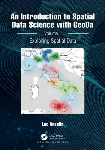
An Introduction to Spatial Data Science with GeoDa. Volume 1: Exploring Spatial Data
4.5
بر اساس نظر کاربران

شما میتونید سوالاتتون در باره کتاب رو از هوش مصنوعیش بعد از ورود بپرسید
هر دانلود یا پرسش از هوش مصنوعی 2 امتیاز لازم دارد، برای بدست آوردن امتیاز رایگان، به صفحه ی راهنمای امتیازات سر بزنید و یک سری کار ارزشمند انجام بدینکتاب های مرتبط:
معرفی کتاب: An Introduction to Spatial Data Science with GeoDa. Volume 1: Exploring Spatial Data
کتاب An Introduction to Spatial Data Science with GeoDa. Volume 1: Exploring Spatial Data نوشتهی «لوک انسلین» یکی از منابع برجسته در زمینه علوم داده مکانی است که به طور خاص نرمافزار محبوب GeoDa را برای تجزیه و تحلیل دادههای فضایی معرفی میکند. این کتاب اولین جلد از مجموعهای است که با هدف ایجاد درک عمیقتر از دادههای مکانی، روشهای بصریسازی، و ابزارهای تحلیلی نوشته شده است.
خلاصهای از کتاب
این کتاب در درجه اول برای کسانی طراحی شده است که تازه وارد حوزه علوم داده مکانی شدهاند یا قصد دارند با مفاهیم ابتدایی استفاده از GeoDa آشنا شوند. محتوا به گونهای طراحی شده که هم برای دانشجویان و هم برای متخصصانی که به دنبال گسترش دانش خود در زمینه Spatial Data Science هستند، مفید واقع شود. این نسخه بر روی بررسی اصول اولیه تحلیل دادههای مکانی با استفاده از GeoDa متمرکز است و موضوعاتی همچون بارگذاری دادهها، آنالیز اکتشافی (Exploratory Data Analysis یا EDA)، و نقشهسازی ساده و پیشرفته را پوشش میدهد. در هر فصل، مفاهیم به زبانی ساده و قابلفهم با کمک مثالهای واقعی توضیح داده شدهاند. همچنین، تأکید ویژهای بر اهمیت تجسم داده برای تحلیل بهتر تاکید شده است.
نکات کلیدی کتاب
- آموزش کار با GeoDa به زبان ساده
- بررسی اهمیت تحلیل دادههای مکانی و نقش آن در دنیای امروز
- آشنایی با تکنیکهای تجسم سازی (Visualization) قدرتمند برای درک بهتر داده
- راهنمای گام به گام برای پیادهسازی Exploratory Data Analysis
- ارائه مثالها و تمرینهای عملی برای تسلط بیشتر
جملات معروف از کتاب
"Spatial data is more than just coordinates; it holds the key to understanding the world we live in."
"Using GeoDa isn't just about maps; it's about making sense of the patterns that shape our surroundings."
چرا این کتاب اهمیت دارد؟
در دنیای امروز که دادههای مکانی در تمامی حوزهها از جمله برنامهریزی شهری، محیط زیست، و حتی علوم اجتماعی اهمیت روزافزونی پیدا کردهاند، دانستن نحوه کار با ابزارهایی مانند GeoDa به یک الزام تبدیل شده است. این کتاب نه تنها شما را با ابزارهای کارآمدی برای کاوش دادههای مکانی آشنا میکند، بلکه به شما نشان میدهد چگونه از دادهها برای استخراج اطلاعات مفید، تجسم الگوها، و تصمیمگیری مبتنی بر شواهد استفاده کنید. این کتاب، پلی است میان مفاهیم نظری و کاربرد عملی، و باعث میشود که دانشآموختگان این حوزه آماده ورود به بازار کار یا پروژههای تحقیقاتی شوند. اگر به دنبال یادگیری روشی علمی و کاربردی در تعامل با دادههای مکانی هستید، این کتاب بهترین انتخاب برای شروع خواهد بود.
An Introduction to Spatial Data Science with GeoDa. Volume 1: Exploring Spatial Data
Spatial data science is a rapidly growing discipline that lies at the intersection of geography, statistics, and computer science. In the first volume of the series, "An Introduction to Spatial Data Science with GeoDa. Volume 1: Exploring Spatial Data," Luc Anselin provides a comprehensive foundation for understanding and analyzing spatial data using the powerful GeoDa software. This book is meticulously crafted to guide readers through the fascinating world of spatial analysis while honing practical skills and fostering a strong grasp of spatial data concepts.
Detailed Summary
The book serves as both an accessible introduction and a robust manual for those seeking to understand spatial data and the science of analyzing it. Designed for researchers, students, and practitioners, this volume focuses on the exploration of spatial data, emphasizing the importance of visualization, summarization, and the detection of spatial patterns. By leveraging GeoDa, an open-source software renowned for spatial analysis, the book equips readers with practical tools and examples to build their expertise.
In this volume, Luc Anselin takes a step-by-step approach to unravel spatial data, starting with basic concepts such as data structure, mapping, and visualization techniques. The reader is introduced to the nuances of spatial autocorrelation, cluster analysis, and geographic patterns within datasets. With carefully curated exercises and real-world examples, the book emphasizes the relevance of spatial characteristics and relationships in a wide range of fields, including urban planning, public health, and environmental studies.
The book’s primary strength lies in its application-oriented methodology. It integrates theory and practice seamlessly, illustrating how quantitative methods and computational tools converge to explore spatial phenomena. Whether you are new to spatial data analysis or looking to deepen your existing knowledge, this book offers invaluable insights and hands-on guidance.
Key Takeaways
- A detailed introduction to the principles of spatial data science, including concepts like spatial relationships, spatial patterns, and exploratory spatial data analysis (ESDA).
- Practical tutorials on using GeoDa software for mapping, visualizing, and understanding spatial datasets.
- Hands-on exercises and workflows that help readers apply spatial data techniques to practical problems in various fields.
- Guidance on interpreting spatial visualizations and identifying meaningful patterns in spatial data.
- A foundation to prepare for advanced topics such as spatial statistics and spatial econometrics (to be addressed in future volumes).
Famous Quotes from the Book
"Spatial data analysis is more than just a set of tools; it is a way of thinking about the world and understanding the hidden patterns within it."
"The exploration of spatial data begins not with complex models, but with simple, intuitive maps and visualizations that reveal the story embedded in the data."
"GeoDa is not just software—it is an ecosystem that allows researchers to engage with spatial data science in a meaningful and accessible way."
Why This Book Matters
This book is a cornerstone for anyone venturing into spatial data science. It provides a gateway to a domain that impacts countless fields, from public health to urban planning, environmental conservation, and beyond. With the explosion of spatial data availability in the digital era, mastering its analysis is no longer optional—it is a necessity.
What sets this book apart is its ability to simplify complex concepts while maintaining scientific rigor. Luc Anselin's expertise and teaching style make the subject approachable, whether you are an aspiring data scientist, a seasoned researcher, or a policy professional seeking to harness the power of spatial data. The use of GeoDa throughout the book ensures that readers have free access to cutting-edge tools for real-world spatial analysis.
Moreover, "Exploring Spatial Data" lays the groundwork for deepening the understanding of spatial relationships and prepares readers for the journey ahead, as subsequent volumes in the series delve into advanced topics. This book matters because it democratizes spatial data science, empowering individuals from diverse backgrounds to embark on their analytical journeys.
Whether you are mapping disease outbreaks, analyzing urban infrastructure, or studying social patterns, this book equips you with the knowledge and tools necessary to uncover meaningful insights from spatial data. It is an essential resource for the modern analyst, blending theory with practical applications and making spatial data science accessible to all.
دانلود رایگان مستقیم
شما میتونید سوالاتتون در باره کتاب رو از هوش مصنوعیش بعد از ورود بپرسید
دسترسی به کتابها از طریق پلتفرمهای قانونی و کتابخانههای عمومی نه تنها از حقوق نویسندگان و ناشران حمایت میکند، بلکه به پایداری فرهنگ کتابخوانی نیز کمک میرساند. پیش از دانلود، لحظهای به بررسی این گزینهها فکر کنید.
این کتاب رو در پلتفرم های دیگه ببینید
WorldCat به شما کمک میکنه تا کتاب ها رو در کتابخانه های سراسر دنیا پیدا کنید
امتیازها، نظرات تخصصی و صحبت ها درباره کتاب را در Goodreads ببینید
کتابهای کمیاب یا دست دوم را در AbeBooks پیدا کنید و بخرید
1241
بازدید4.5
امتیاز0
نظر98%
رضایتنظرات:
4.5
بر اساس 0 نظر کاربران
Questions & Answers
Ask questions about this book or help others by answering
No questions yet. Be the first to ask!
