Book guide and evaluation
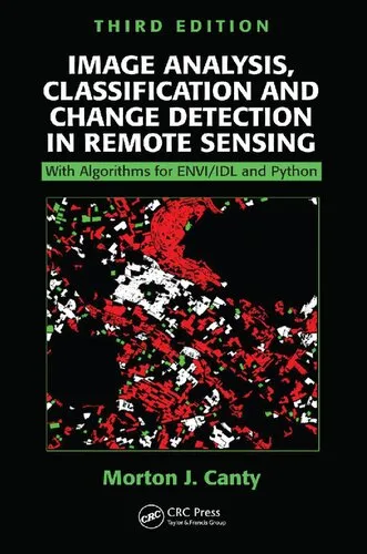
Image Analysis, Classification and Change Detection in Remote Sensing: With Algorithms for Python, Fourth Edition
Canty,Morton John
English
Beginner
Machine Learning
4.5 / 5
0 reviews
2019
Published
530
pages
510
views
Introduction to "Image Analysis, Classification and Change Detection in Remote Sensing: With Algorithms for Python, Fourth Edition" The field of remote sensing has evolved dramatically over the past few decades, fostering significant advancements in image analysis and inte
Before you read
What will you get from this book?
Introduction to "Image Analysis, Classification and Change Detection in Remote Sensing: With Algorithms for Python, Fourth Edition"
The field of remote sensing has evolved dramatically over the past few decades, fostering significant advancements in image analysis and interpretation. My book, "Image Analysis, Classification and Change Detection in Remote Sensing: With Algorithms for Python, Fourth Edition," offers a comprehensive guide targeted at exploring the theoretical underpinnings and practical implementations of image analysis techniques. With a focus on Python programming, this edition is meticulously designed to cater to beginners, researchers, and advanced practitioners alike, ensuring a seamless understanding of both core concepts and cutting-edge practices.
Detailed Summary of the Book
Remote sensing is an interdisciplinary science that integrates knowledge from physics, computer science, and geography to extract meaningful insights from Earth observation data. This book serves as an all-encompassing resource that dives deep into the fundamental principles of remote sensing, the tools required for image analysis, and the development of sophisticated algorithms for classification and change detection.
The fourth edition shifts its focus toward Python, incorporating open-source libraries such as NumPy, SciPy, matplotlib, and GDAL to harness the power of computational image analysis. Practicality takes center stage, as numerous coding examples are presented throughout the material to strengthen the learning experience. From advanced filtering and feature extraction to supervised and unsupervised classification methods, the book systematically explores a variety of image processing techniques. It also dedicates significant attention to the application of machine learning algorithms, offering insights into how these methods can streamline tasks like land cover classification and environmental monitoring.
A unique feature of this book is its focus on change detection strategies, enabling users to monitor temporal changes in satellite imagery effectively. With practical implementation guides, discussion of real-life remote sensing challenges, and in-depth explanations of statistical methodologies, readers will emerge equipped to deal with a diverse range of tasks—whether developing their own algorithms or analyzing multi-temporal datasets.
Key Takeaways
- Thorough understanding of remote sensing principles, techniques, and datasets.
- Hands-on knowledge of Python's essential libraries for geospatial image analysis.
- Practical implementation of supervised and unsupervised classification algorithms.
- Comprehensive workflows for change detection and multi-temporal analysis.
- Exposure to the latest advancements in image processing and machine learning for remote sensing.
- Step-by-step guidance on creating algorithms tailored to specific research needs.
Famous Quotes from the Book
"In remote sensing, every pixel is worth a thousand measurements. Understanding the overwhelming complexity of data is what turns images into actionable insights."
"Classification is not merely a task of grouping pixels; it is a scientific endeavor to identify patterns and relationships within the imagery, to unlock the secrets of our world."
Why This Book Matters
This book matters because it fills a critical gap in the intersection of remote sensing and software implementation. While many texts discuss the theoretical aspects of image analysis, few offer a balanced combination of theory and practical exercises, particularly with open-source tools like Python.
In an era where data-driven decisions shape industries, this book empowers readers to use satellite imagery for solving real-world problems—from environmental monitoring to urban planning. It provides a toolkit for professionals and academics who are looking to transition from conceptual learning to hands-on expertise.
Furthermore, its focus on open-source solutions ensures that the methods discussed are accessible and scalable, democratizing remote sensing education in a meaningful way. The fourth edition's emphasis on Python makes it especially relevant in today’s world, where Python has become a dominant programming language in the fields of data science and machine learning.
For anyone seeking a comprehensive, practical, and accessible introduction to remote sensing with Python, this book is an invaluable resource that will guide you through basic concepts all the way to advanced applications.
Ask this book
Your question is answered in the context of this title and author. Each answer uses 2 points.
Sign in to ask the book assistant.
Reader reviews
0 reviews, 4.5 average out of 5
No reviews yet
If you have read this book, help the next reader with your experience.
Write a review
Sign in to publish a review.
Reader questions and answers
Ask a focused question and learn from the community.
Sign in to ask or answer a question.
No questions yet
Be the first to ask a clear, useful question.
What to read next
Related references that continue this learning path.
Distributed Artificial Intelligence: A Modern Approach
Satya Prakash Yadav (editor),Dharmendra Prasad Mahato (editor),Nguyen Thi Dieu Linh (editor)
2021
View book