
Book guide and evaluation
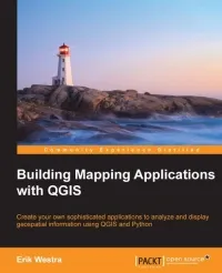
Building Mapping Applications with QGIS: Create your own sophisticated applications to analyze and display geospatial information using QGIS and Python
Erik Westra
English
Unordered
Software Development
4.3 / 5
0 reviews
2014
Published
264
pages
443
views
QGIS is one of the premiere open source Geographical Information Systems. While developing Python geospatial applications can be challenging, QGIS simplifies the process by combining the necessary geoprocessing libraries with a sophisticated user interface, all of which can be di
Before you read
What will you get from this book?
QGIS is one of the premiere open source Geographical Information Systems. While developing Python geospatial applications can be challenging, QGIS simplifies the process by combining the necessary geoprocessing libraries with a sophisticated user interface, all of which can be directly controlled using Python code. Starting with an introduction to QGIS and how to use the built-in QGIS Python Console, we will teach you how to write Python code that makes use of the geospatial capabilities of QGIS. Building on this, you will ultimately learn how to create your own sophisticated standalone mapping applications built on top of QGIS. You will learn how to use the Python Console as a window into the QGIS programming environment, and then use that environment to create your own Python scripts and plugins to customize QGIS.
Ask this book
Your question is answered in the context of this title and author. Each answer uses 2 points.
Sign in to ask the book assistant.
Reader reviews
0 reviews, 4.3 average out of 5
No reviews yet
If you have read this book, help the next reader with your experience.
Write a review
Sign in to publish a review.
Reader questions and answers
Ask a focused question and learn from the community.
Sign in to ask or answer a question.
No questions yet
Be the first to ask a clear, useful question.
What to read next
Related references that continue this learning path.
Practical System Programming with C - Pragmatic Example Applications in Linux and Unix-Based Operating Systems.
Sri Manikanta Palakollu
2021
View book