

معرفی و ارزیابی کتاب
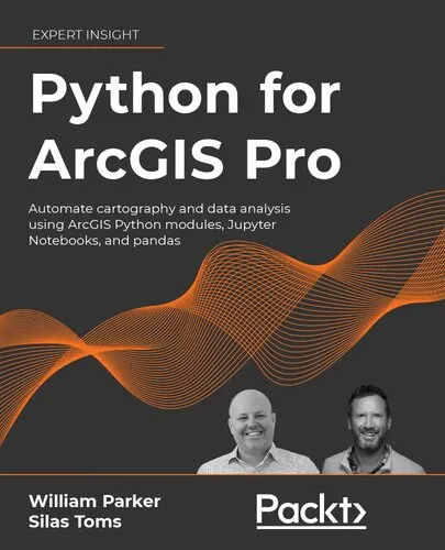
Python for ArcGIS Pro: Automate cartography and data analysis using ArcGIS Python modules, Jupyter Notebooks, and pandas
William Parker,Silas Toms
English
Advanced
مدیریت محصول
4.3 / 5
0 نظر
2022
سال انتشار
469
صفحه
494
بازدید
Get well versed with the core concepts of ArcGIS Pro through hands-on exercises and real-world case studiesKey FeaturesMaster the core components of arcpy for ArcGIS Pro and how to use the ArcGIS API for Python for ArcGIS OnlineGet practical expertise on each topic with hands-on
پیش از خواندن
این کتاب چه چیزی به شما میدهد؟
Get well versed with the core concepts of ArcGIS Pro through hands-on exercises and real-world case studiesKey FeaturesMaster the core components of arcpy for ArcGIS Pro and how to use the ArcGIS API for Python for ArcGIS OnlineGet practical expertise on each topic with hands-on exercises in every chapter and real-world case studies at the end of the bookUnderstand concepts with respect to Jupyter Notebooks integrated throughout the bookFocus on data science using Pandas, SciPy, and ArcGIS Pro for raster and vector analysisBook DescriptionIrrespective of one’s level of expertise with Esri software, a good command of Python is necessary to drive a geospatial environment. Python proficiency makes even an experienced user of Esri technology/software 5–10-times as valuable as a non-coding GIS analyst. Python for ArcGIS Pro explains how to incorporate scripting at each step from mapping to data science, databases, and data services.The book leads the reader through the major uses of Python programming for ArcGIS Pro - map production, online and offline data management, data analyses, and data visualization. It shows various Python programming options for ArcGIS Pro, and how to integrate them together into a smarter workflow. You’ll learn how to use popular Python packages such as Jupyter Notebooks and pandas to explore and analyze geospatial data, and how to write data engineering scripts to manage ongoing data processing and data transfers. The book concludes with 3 real-world case studies where you’ll apply the concepts you studied earlier.By the end of this book, you will be able to use Python to perform all the major tasks involved with ArcGIS Pro: automating the production of maps for print, managing data between ArcGIS Pro and ArcGIS Online, creating custom script tools for sharing, and then running data analysis on top of the ArcGIS geospatial library, all using Python.What you will learnAutomate map production to make or edit maps at scaleUse Python to automatically update data for ArcGIS OnlinePublishing map layer data to the ArcGIS Online cloud serviceAutomation of data updates and insertsCreate custom script tools for use in ArcGIS Pro and for managing data on ArcGIS OnlineCloud integration with Jupyter notebooks for data science with the panda's toolkitLeverage Jupyter Notebooks interface and the Pandas library (with its underlying NumPy module) to make geospatial data science faster and more interestingWho This Book Is ForThis book is for ArcGIS professionals, intermediate ArcGIS Pro users, ArcGIS Pro power users, students, and people who want to move from being a GIS Technician to GIS Analyst; GIS Analyst to GIS Programmers; and GIS Developers/Programmers to GIS Architects.Basic familiarity with geospatial/GIS syntax, ArcGIS, Python package management and virtual environments, and Data Science (Pandas, Jupyter Notebooks) is preferable.Table of ContentsIntroduction to Python for GISBasics of ArcPyIntroduction to the ArcGIS API for PythonData Access using CursorsPublishing to ArcGIS OnlineArcToolbox Script ToolsAutomated Map ProductionVector Analysis with PandasRaster analysis with PandasGeospatial Data Science with SciPyCase Study: ArcGIS Pro Data ManagementCase Study: Advanced Map ProductionCase Study: Interactive Data Science Web Map
از این کتاب بپرس
پرسشت با عنوان و نویسنده همین کتاب برای دستیار ارسال میشود. هر پاسخ ۲ امتیاز مصرف میکند.
وارد شوید تا بتوانید از دستیار کتاب بپرسید.
نظر خوانندگان
0 نظر، میانگین 4.3 از ۵
هنوز نظری ثبت نشده
اگر این کتاب را خواندهاید، تجربهتان را با دیگران به اشتراک بگذارید.
نظر خودت را بنویس
وارد شوید تا نظر خود را ثبت کنید.
پرسش و پاسخ خوانندگان
سؤال مشخص بپرس و از تجربه جامعه استفاده کن.
وارد شوید تا سؤال بپرسید یا پاسخ بدهید.
هنوز پرسشی ثبت نشده
اولین سؤال روشن و مفید را شما مطرح کنید.
بعد از این چه بخوانم؟
منابع مرتبط برای ادامه همین مسیر.
Mapping with ArcGIS Pro: Design accurate and user-friendly maps to share the story of your data
Amy Rock;Ryan Malhoski
2018
مشاهدهٔ کتاب

Fifty quick ideas to improve your user stories
Gojko Adzic,David Evans,Nikola Korac
2014
مشاهدهٔ کتاب